JunctionScape
Landscape Architecture Core Studio I
JunctionScape
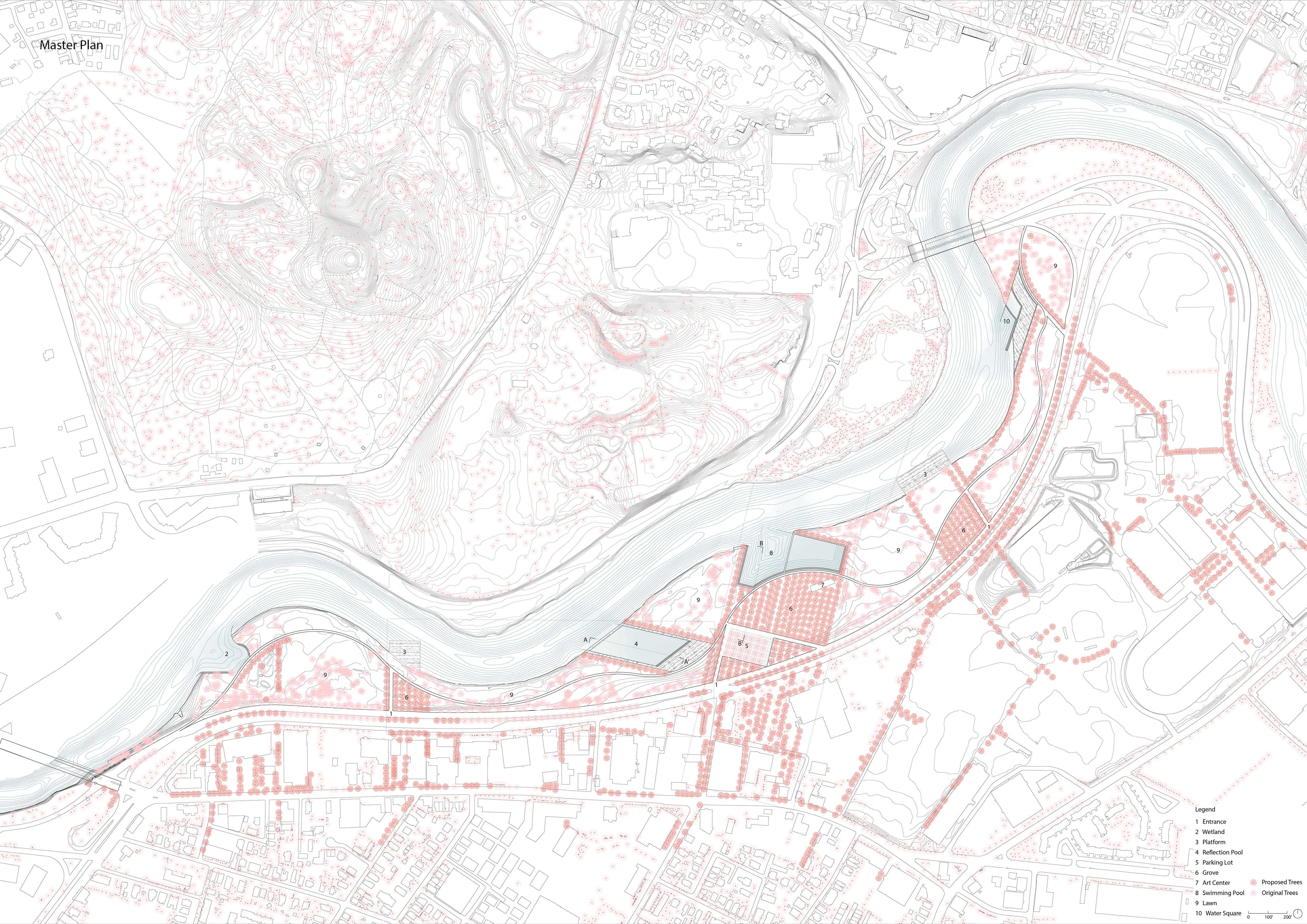
Define a new riverfront public space by introducing water from the Charles River and urban grids from the city to the site.
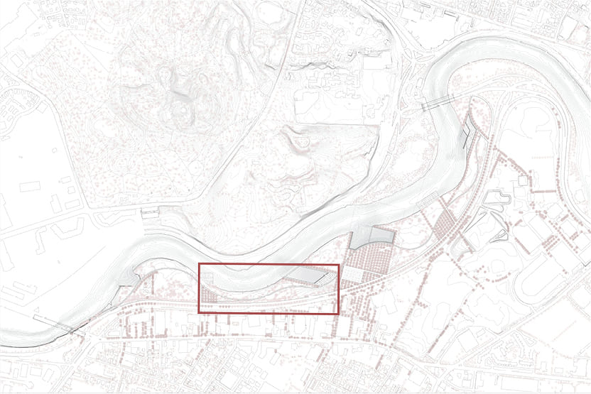
Problem Space
Within urban landscapes, it is the public space, more specifically, what constitutes the fundamental domain in the provision and protection of democracy, for it is in the public space where the most profound manifestations of social conflict, individual self-expression, and cultural exchange take place.
Through the site, I hope to look into public space as representation of our shared conditions of existence, as expression of difference, values, individuality, universality, knowledge, and power, and study how the changes I introduce in the received configuration of the public imply, inevitably, the affirmation, the manipulation, and the suppression of some of those conditions.
How to connect the Charles River waterfront to greater urban system and provide citizens with diverse public spaces?
01. Research
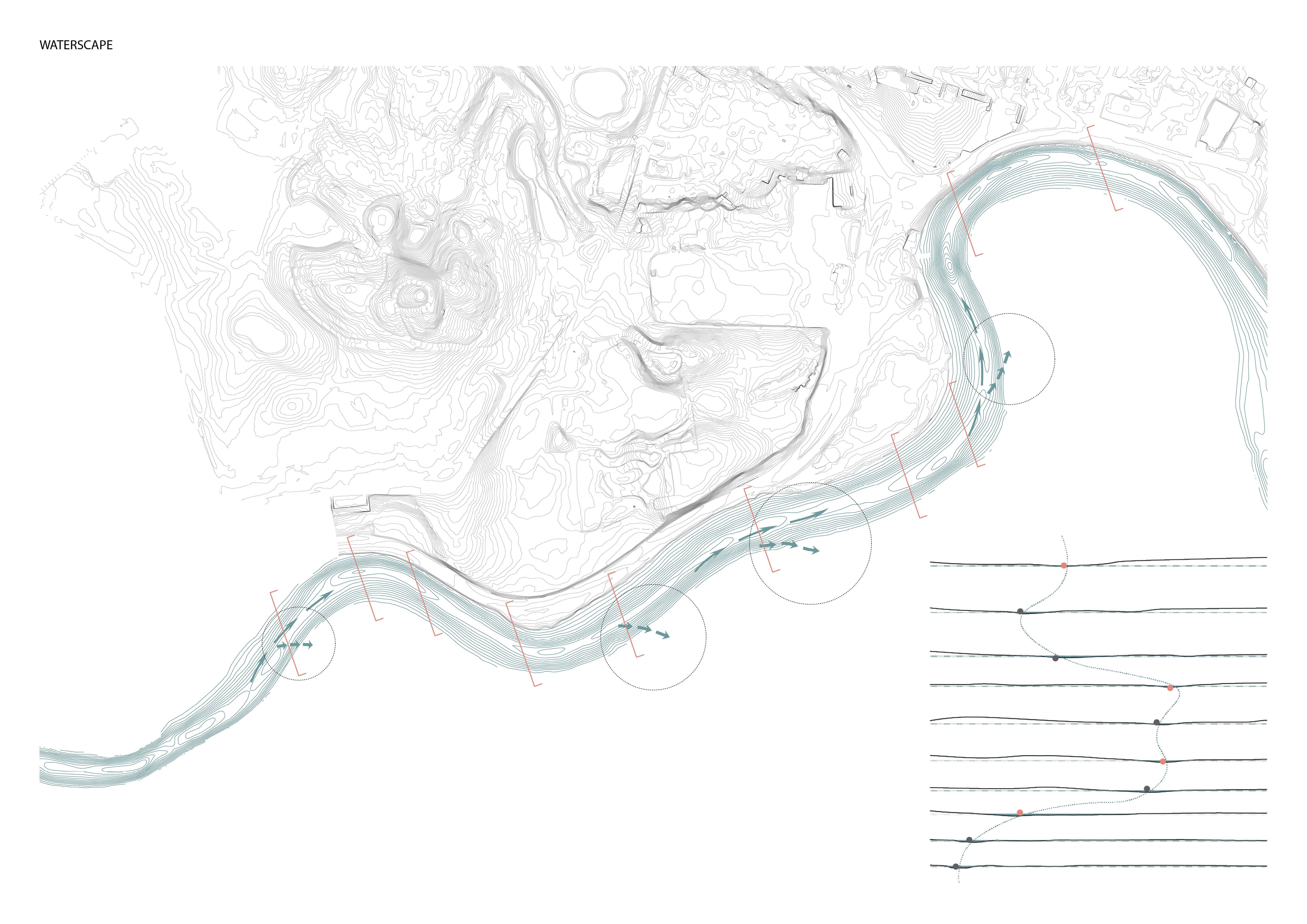
I. Water·Scape
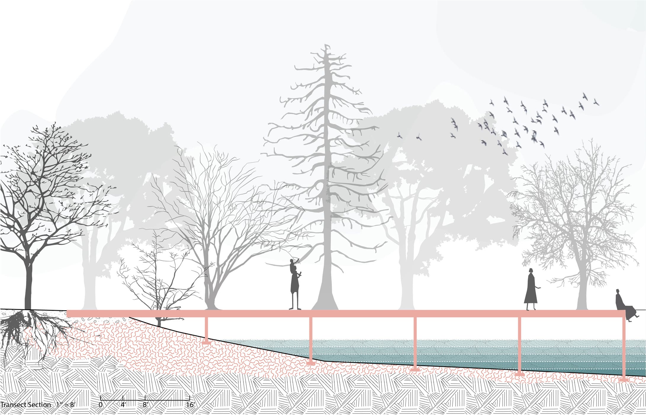
During the field trip, I found the river water slaps the bank as if it has an intention to go out of the river channel.
To study this phenomenon more, I mapped the nodes where the water is the most turbulent on both the plan and continuous sections.

II. Urban·Scape
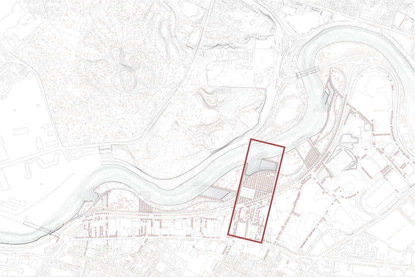
In the site study, the urban axes at the south interested me a lot.
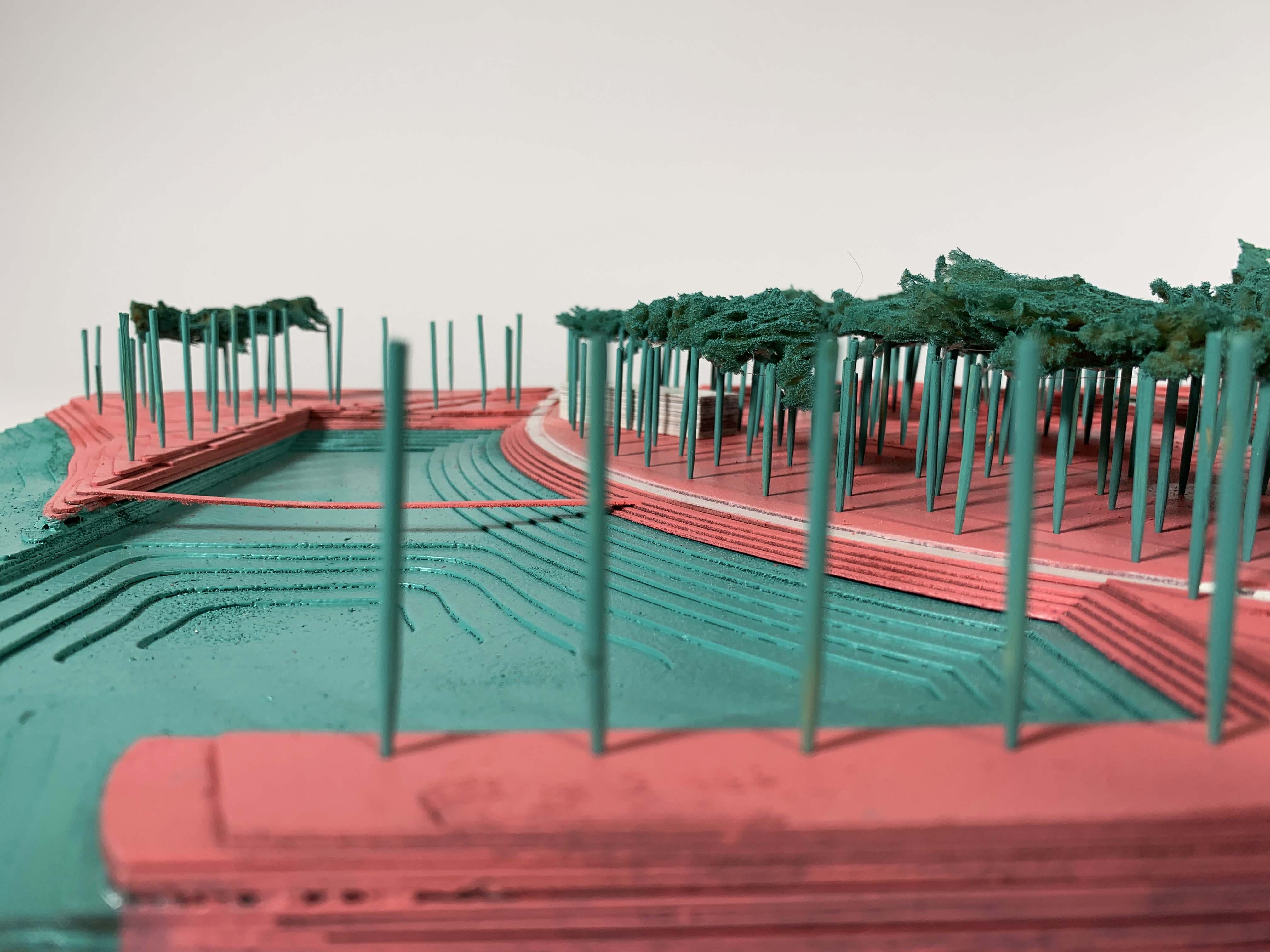
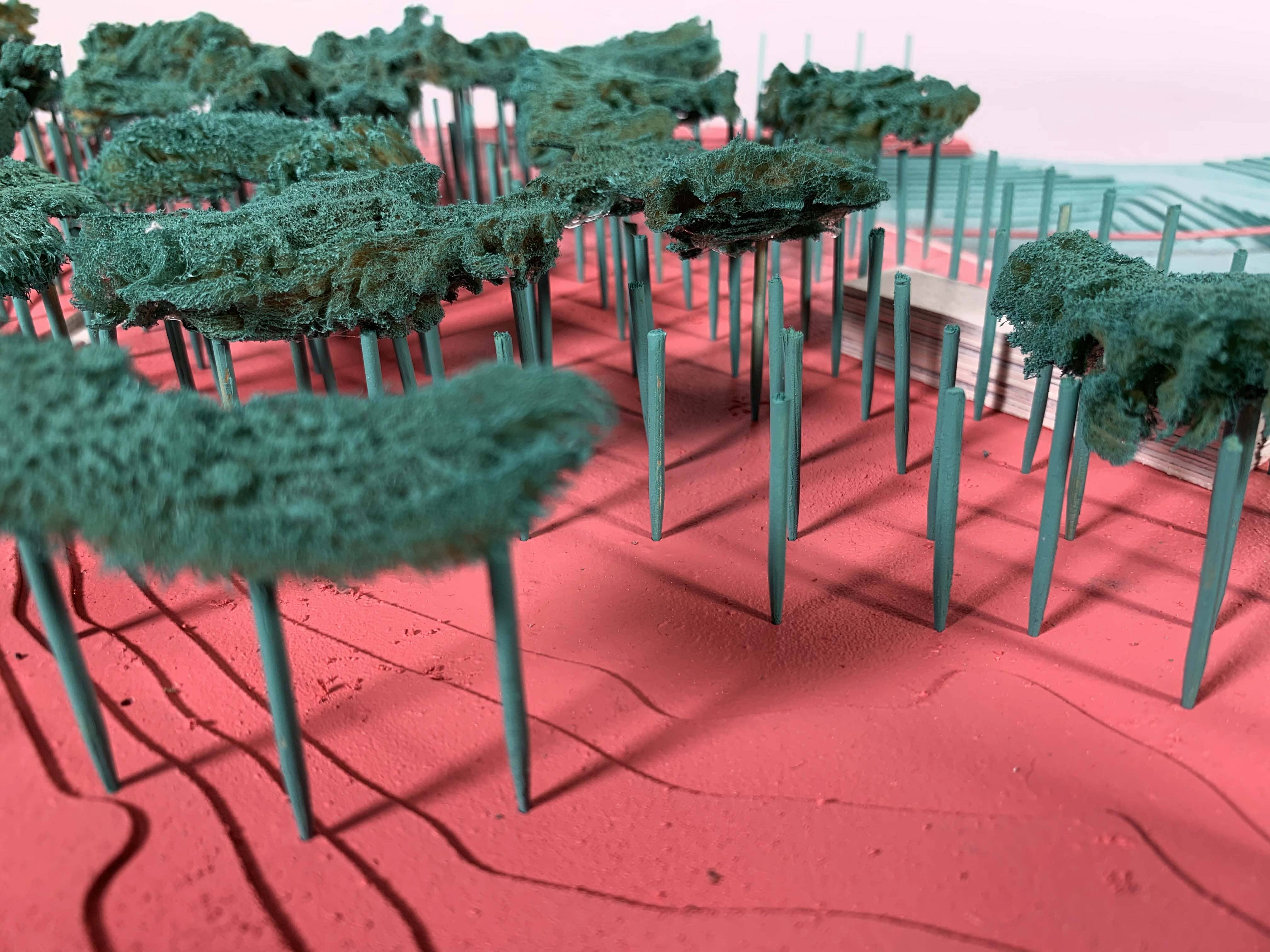
This study led me to a planting strategy that brings urban axes into the site connected to framed wooded areas. Then I connected these trees planted areas to different waterscapes: pools, water squares or river edges.
02. Prototyping
I. Casting Models
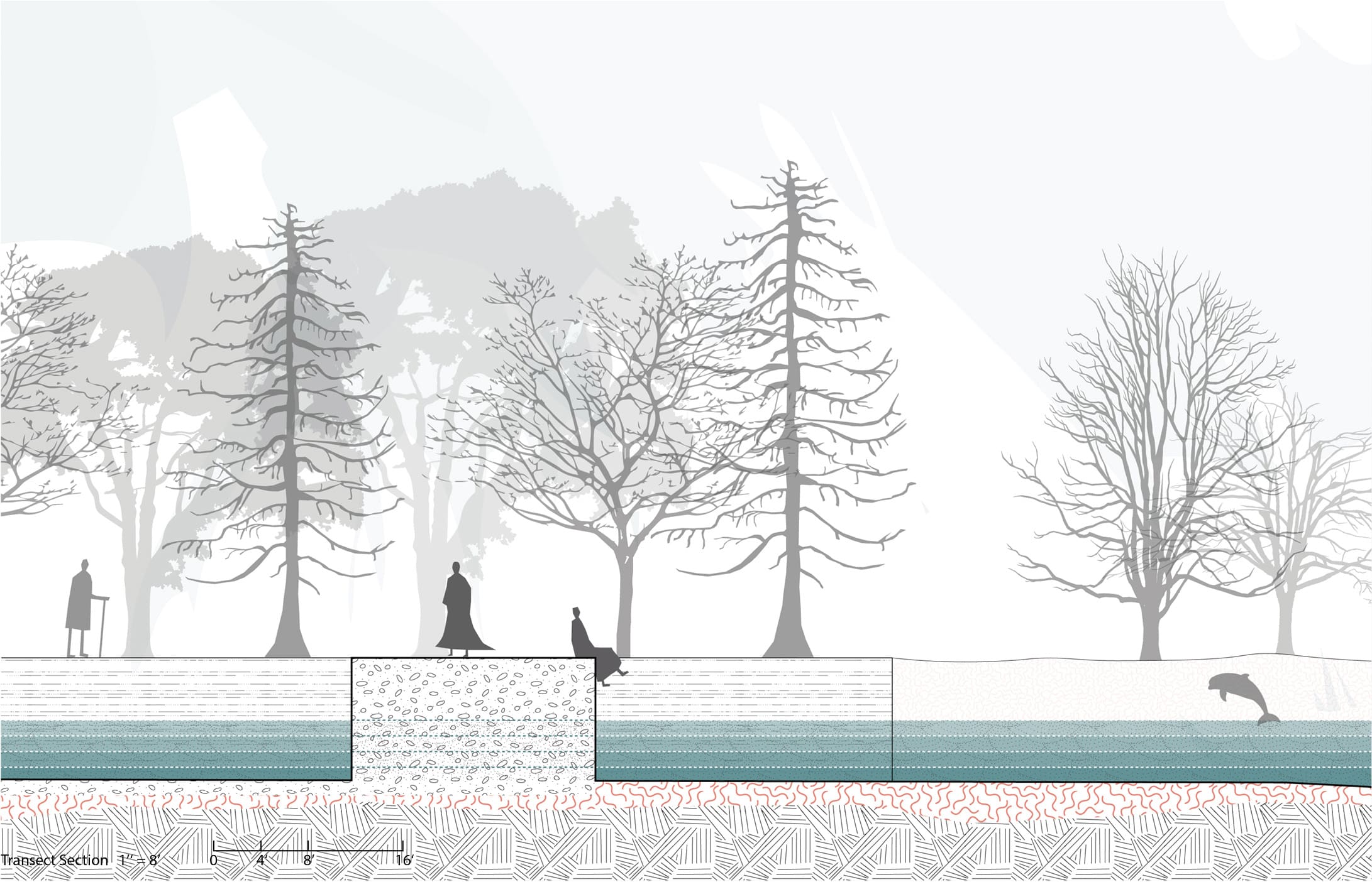
Three types of river edge:
- Natural river edge
- To the water square
- To the swimming pool
II. Space Prototype
Space
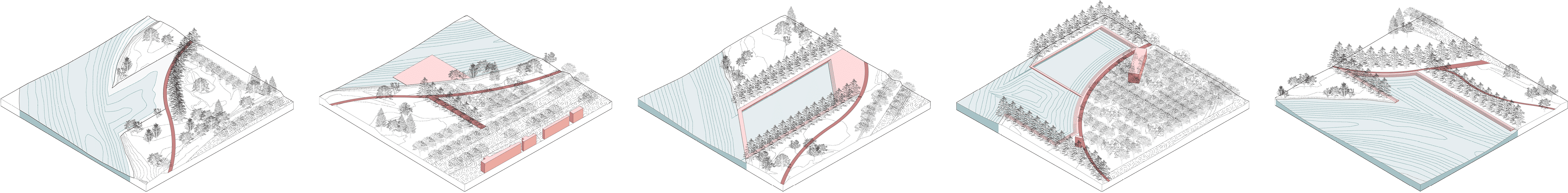
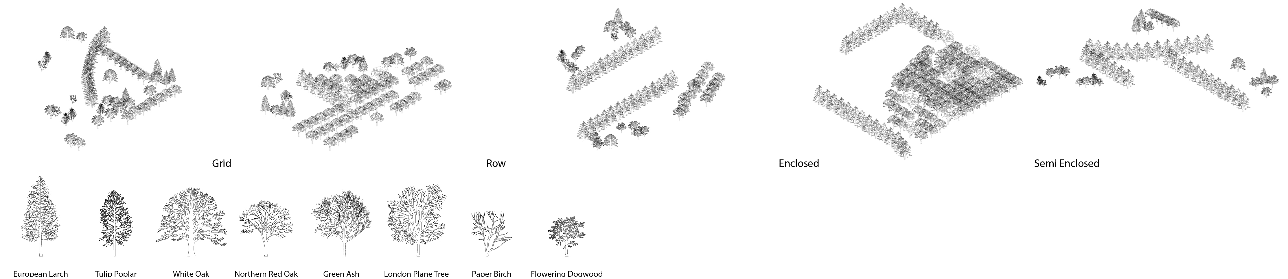
Vegetation
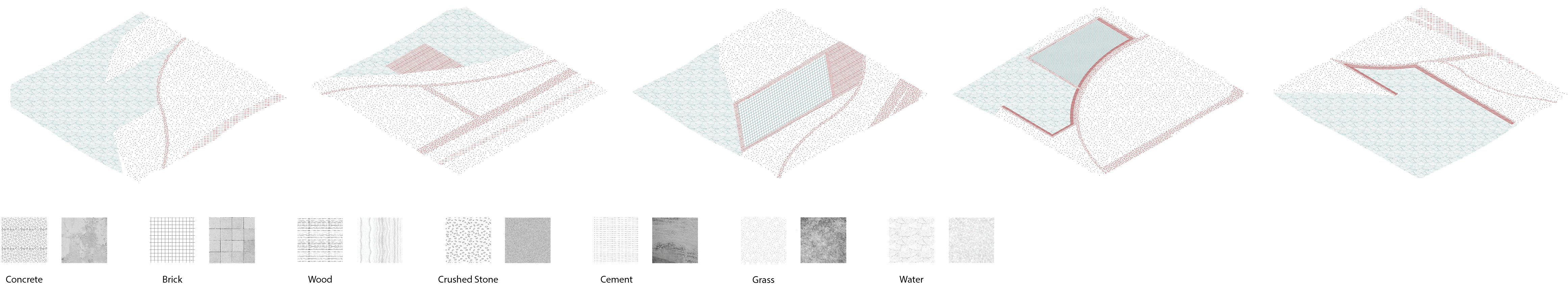
Material
03. Journey Mapping
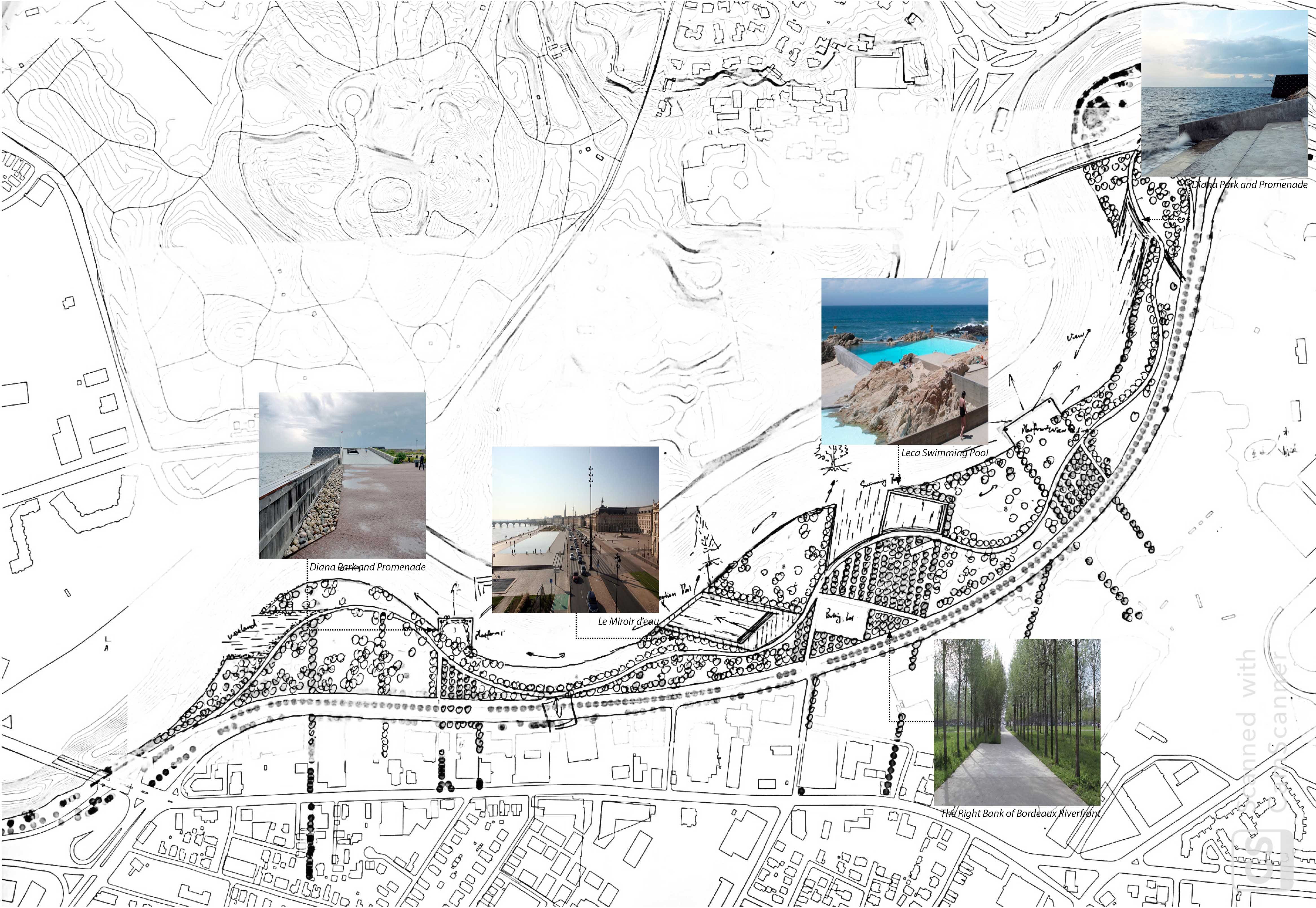
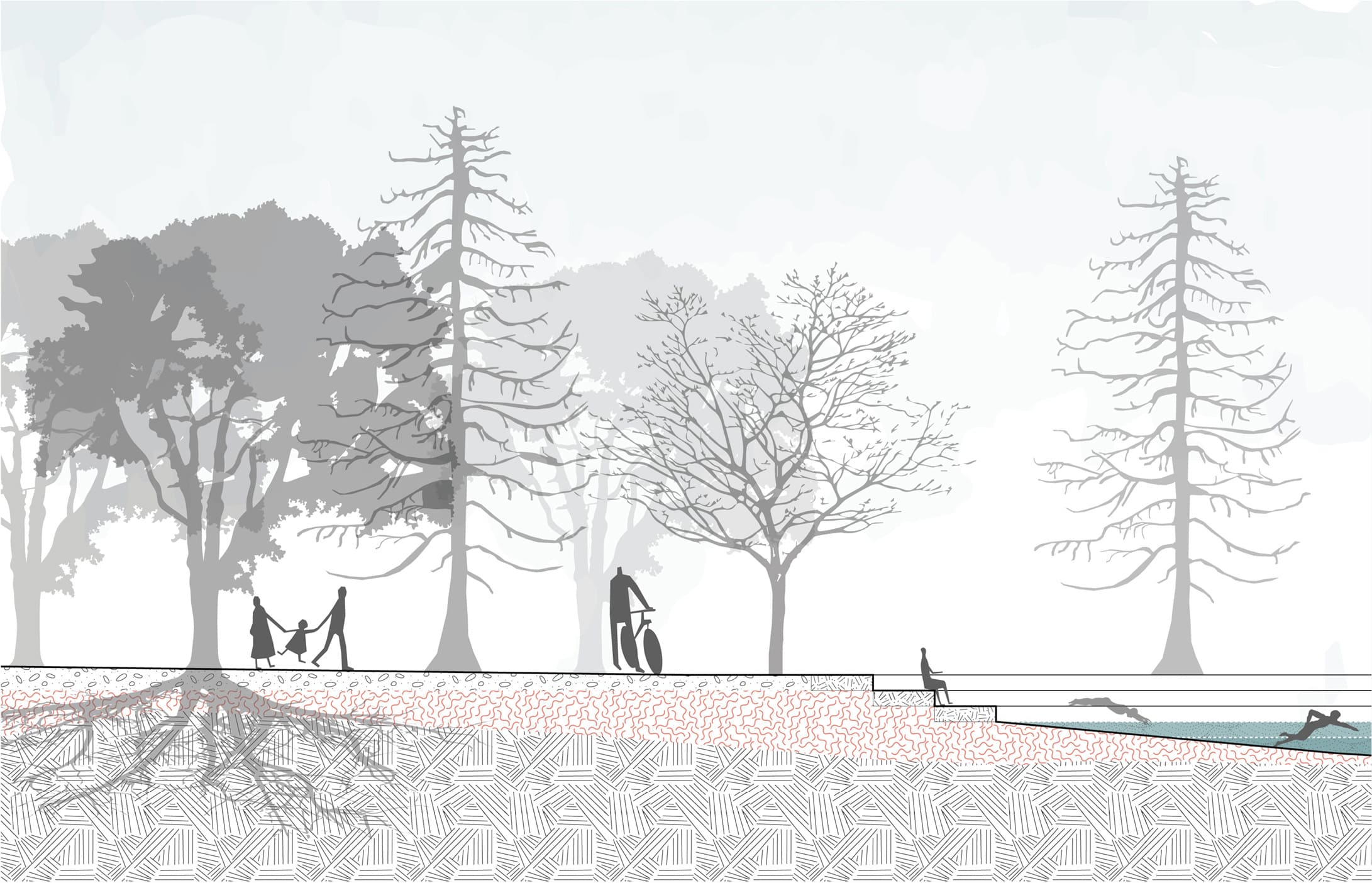
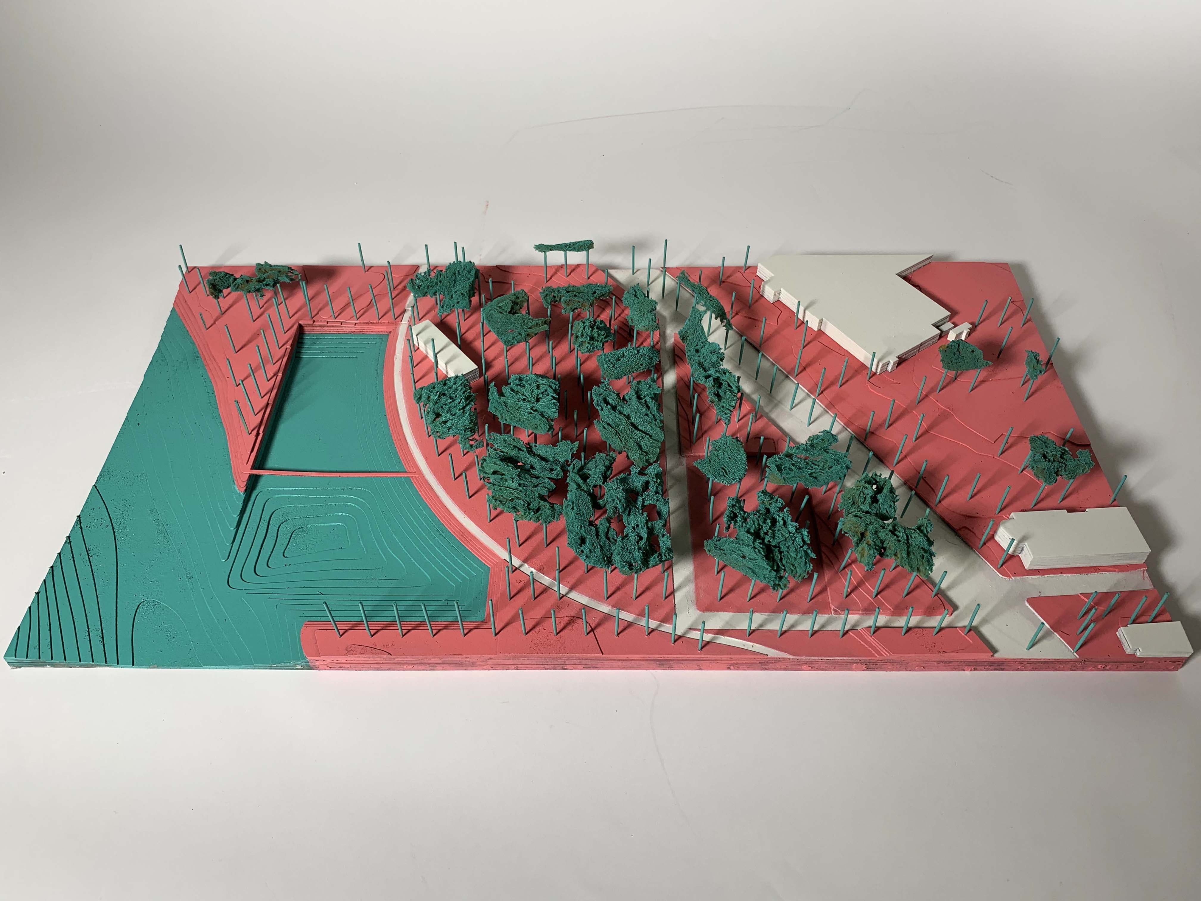
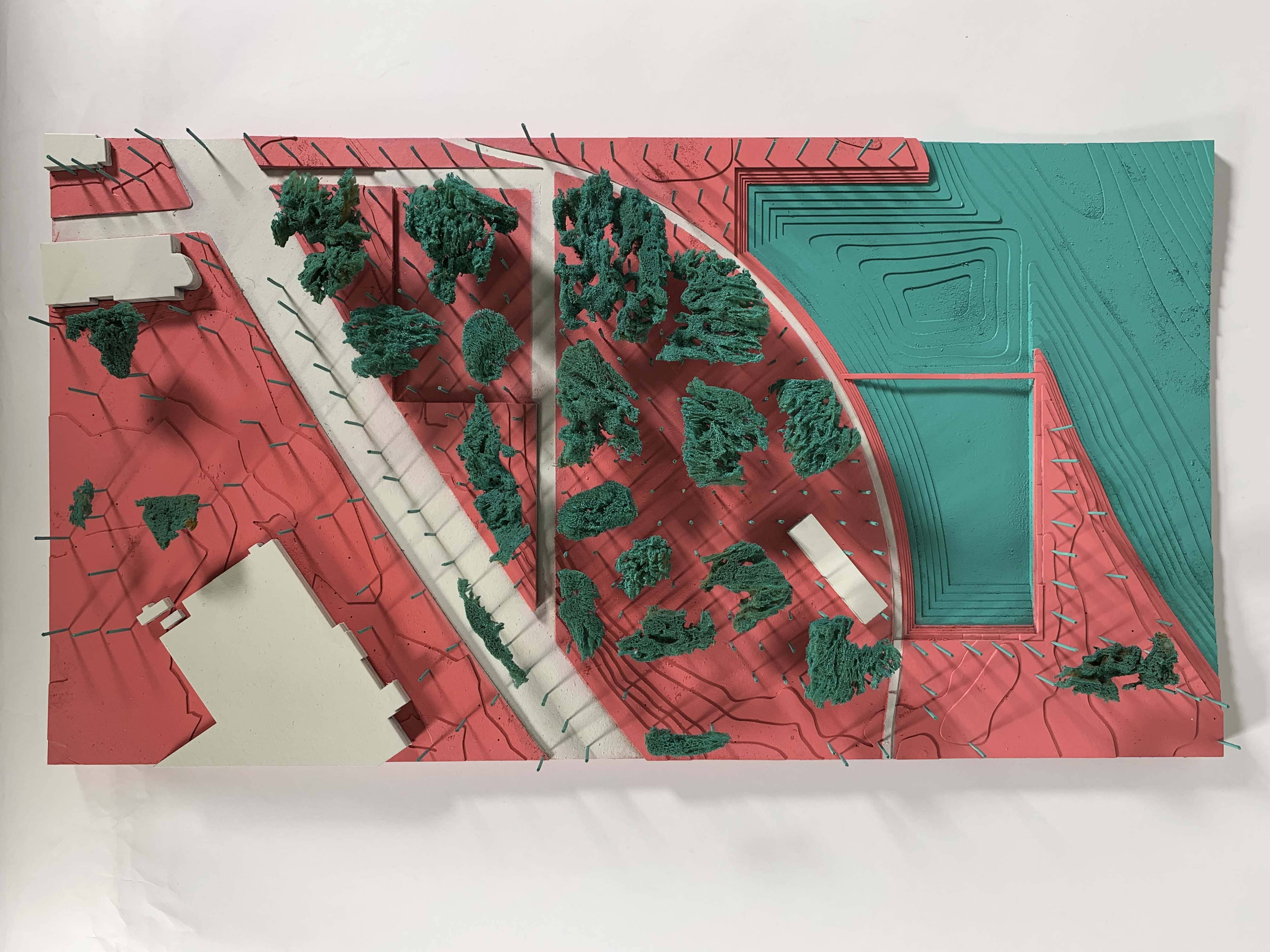
The public spaces are defined together by the wooded areas which are framed by the urban axes, and different waterscapes – pools, water squares and river edges.
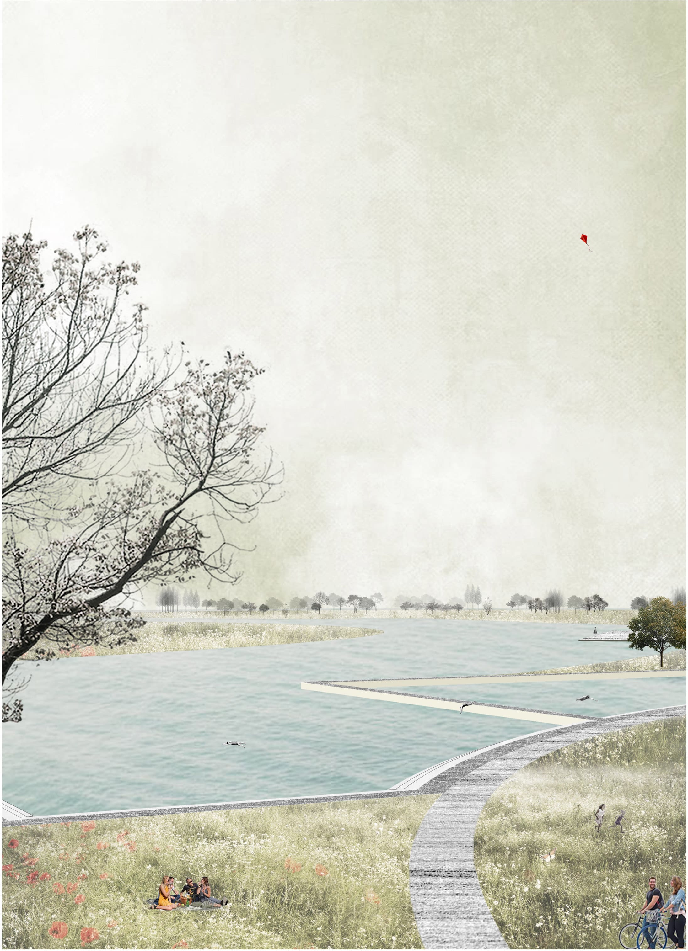
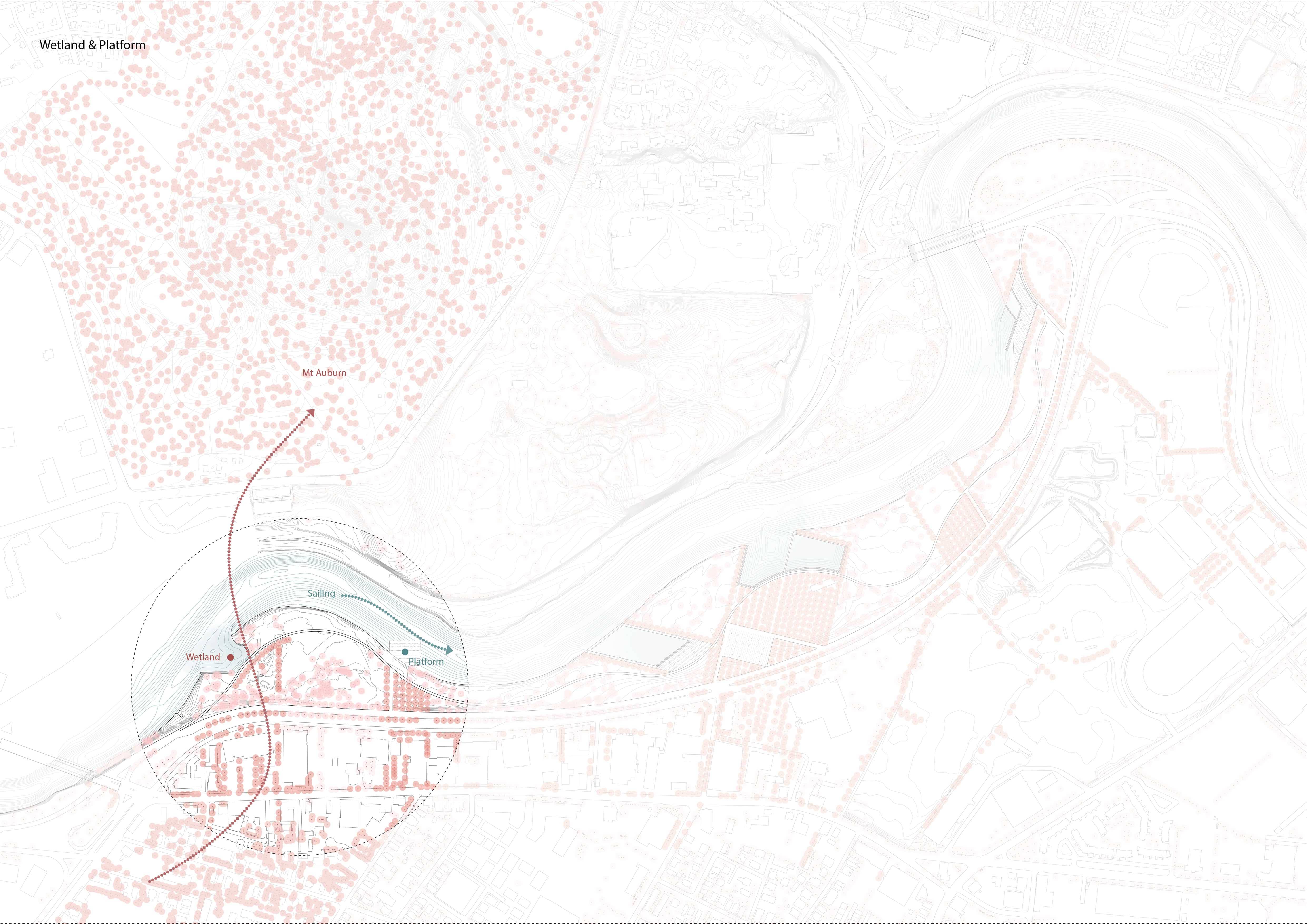
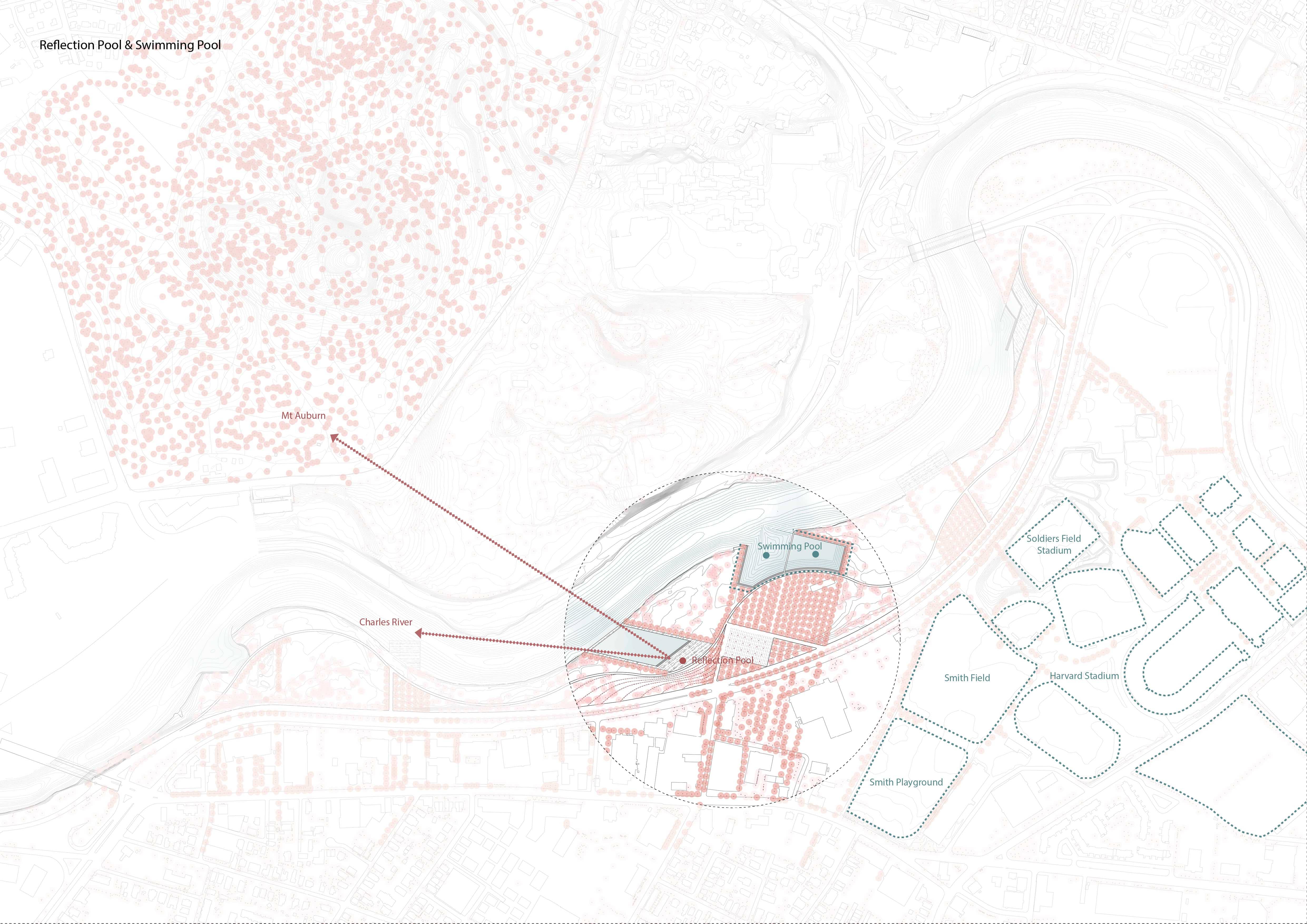
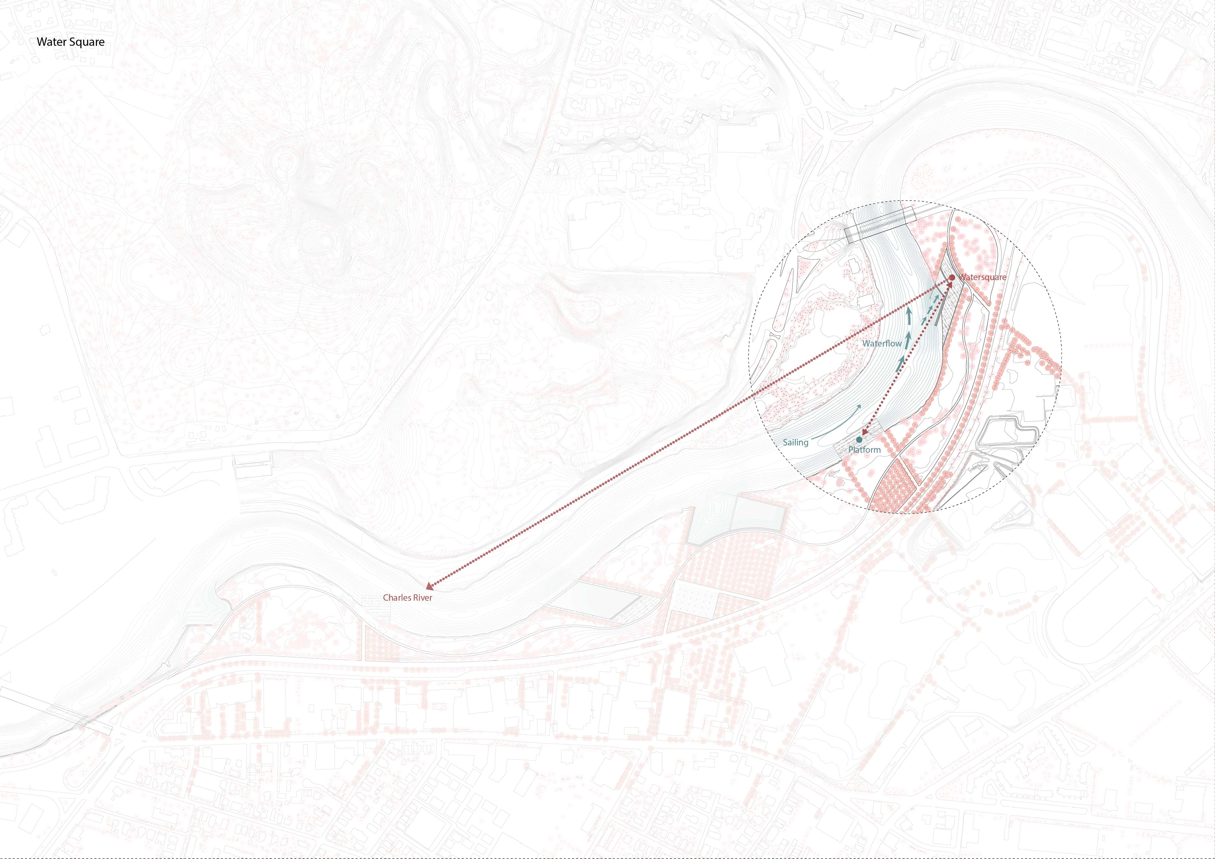
People's spatial experiences along the river is according to the site condition. The reflection pool enables people to have the best view of the Charles river and the Auburn mountains. The swimming pool connected with the Harvard stadiums. The platforms provide spaces to watch the sailing competition and the water square allows people to feel the waves and sit there, looking back to the whole park.
04. Ideation
In the ideation, I worked on connecting the waterfront to the greater urban system with the idea of bringing the city close to the water and vice-versa. The result is a strong connection with the surroundings through a planting strategy that brings urban axes into the site connected to framed wooded areas.
These trees planted areas are connected to different waterscapes: pools, water squares or river edges. My goal is to design a succession of public spaces that using the ecology of a wooded area and the hydrology of the river would define a variety of open spaces, able to allow different communities to experience in multiple ways the waterfront as an urban system of recreation and leisure.
05. Final Designs
I. Reflection Pool
The reflection pool enables people to have the best view of the Charles river and the Auburn mountains.
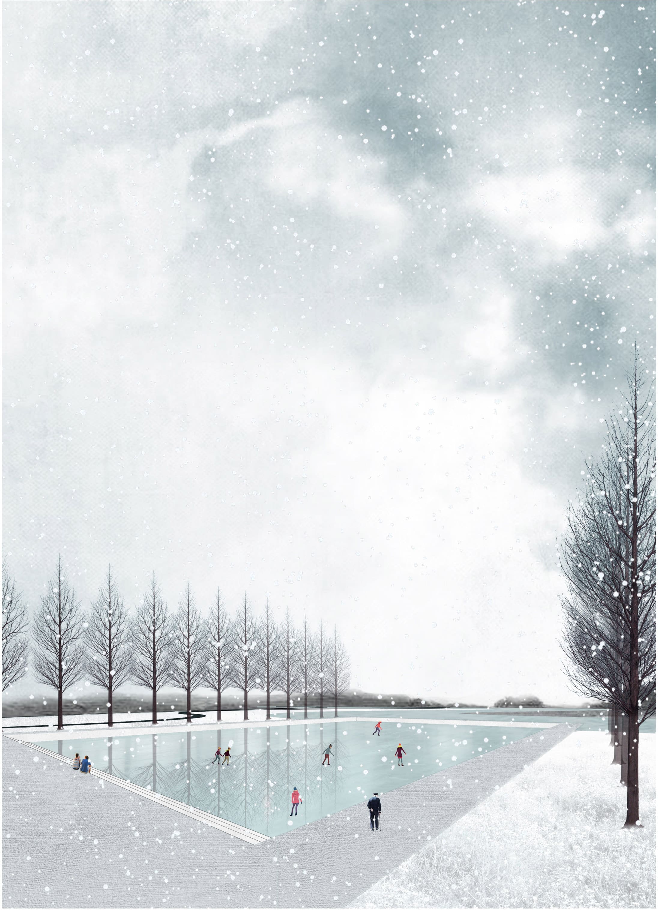
II. Swimming Pool
The swimming pool connected with the Harvard stadiums, providing both the inner pool and outer pool. It is also the end point of the main urban axis.
III. Watersquare
The water square allows people to feel the waves and sit there, looking back to the whole park.
Platforms provide spaces for citizens to watch the sailing competition.
06. Testing
The model tests the space sequence of urban, main road, parking lot, grove, sidewalk, swimming pool and the river; as well as the use of materials and different tree species - Oaks and American Elms are used to create shades and seasonal change, while Redwoods are used to create skyline at waterfront.
07. Impact & Reflections
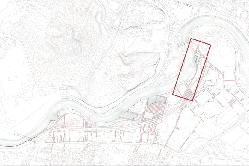
This project is centered on a fifty-five acre segment of the Charles River Reservation.
This public park is one reach of a greater twenty-mile recreational landscape along the river.
It is also a participant in a watershed encompassing one million residents in thirty-five cities and towns.
In a time of rapid and uneven social and ecological change, the project tries to answer this question:
How can the design of a landscape imaginatively invent new and highly legible frameworks for living with water?